UIUCTF 2024 Writeups
Team: example.com
Home OSINT Crypto Miscellaneous
Geoguesser Suite Writeup
Challenge 1: Night
Description
Information gained from prompt
- chal.jpg image file
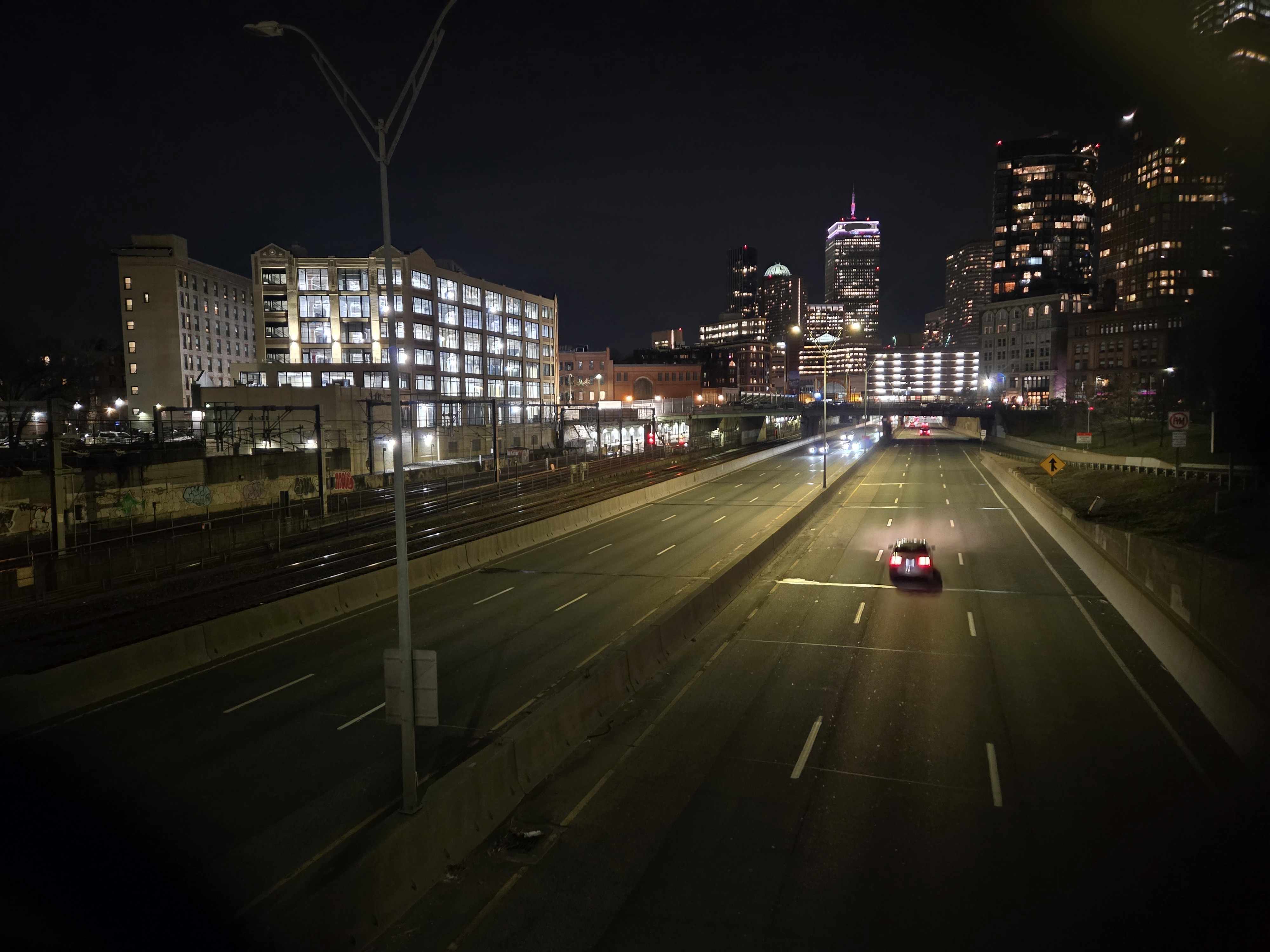
chal.jpg image
Information Gathering Stage
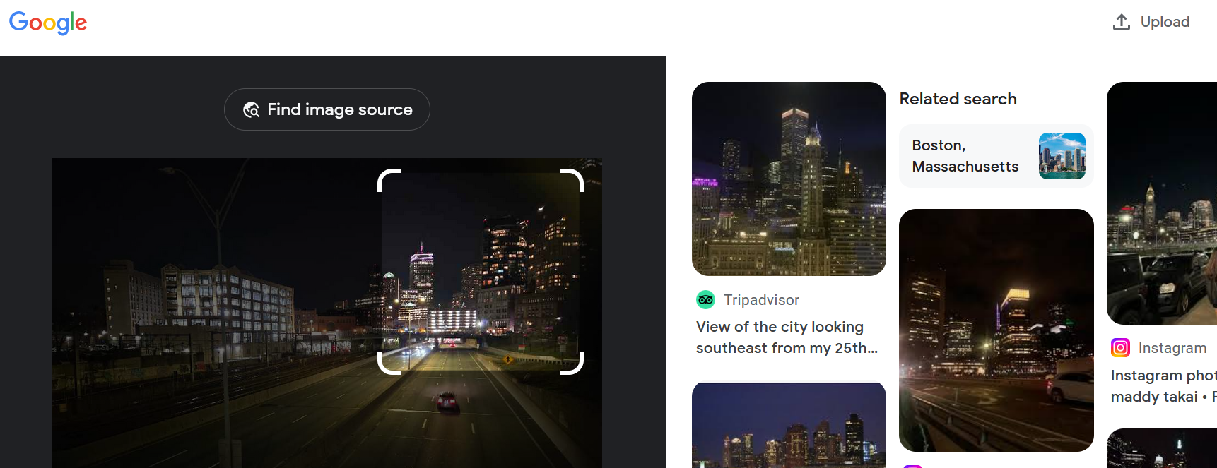
The first thing we did, as any good OSINT challenge contender would do, is run our image through Google Lens.
By selecting the skyline, we are able to quickly find out that we should be looking in Boston, Massachusetts, USA.
Thinking Stage
Next, we need to take a closer look at the image and see what we can find. We notice the skyscrapers, of course, as well as the fact that there is a small bridge ahead and the yellow sign on the right which indicates on incoming merging lane. It is a three lane (x2) two-way road with a barrier in between. There looks to be some sort of railroad tracks to the left of the photo.
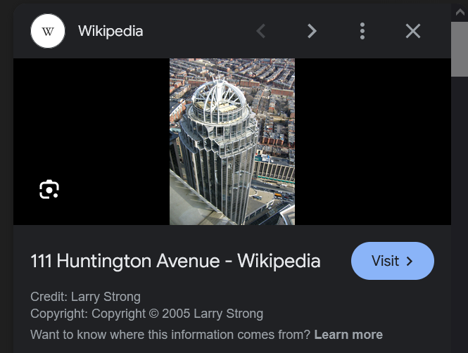
Further selection shows us that the domed building in the background is this building:
With this knowledge, we begin scouring Google Maps for the location, marking the location of the domed building for reference and selecting transit lines to be shown.
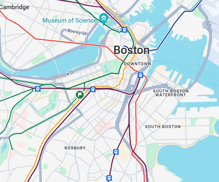
The Solve
We find a heavy rail route and follow along. There is also the two-way three lane road here! We follow along the rail for a while, but then it separates from the road. Since we are more sure about the road, we zoom out a bit and try to find a wide road that also goes along a rail route.
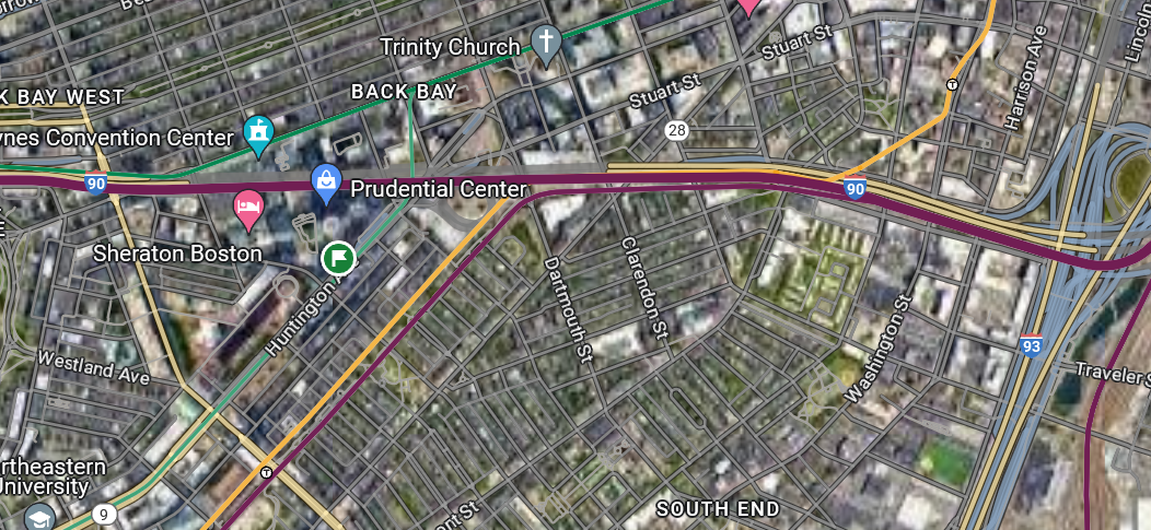
Then we see the big interstate road, that also runs along a heavy rail and would have a view of the skyskraper… hmmm… Zooming in! This looks really promising, since we see lots of bridges and merging areas. We start from where the interstate and the highway merge and go towards the skyskraper, checking where any road merges in. Street view!
Soon enough, we get to here.
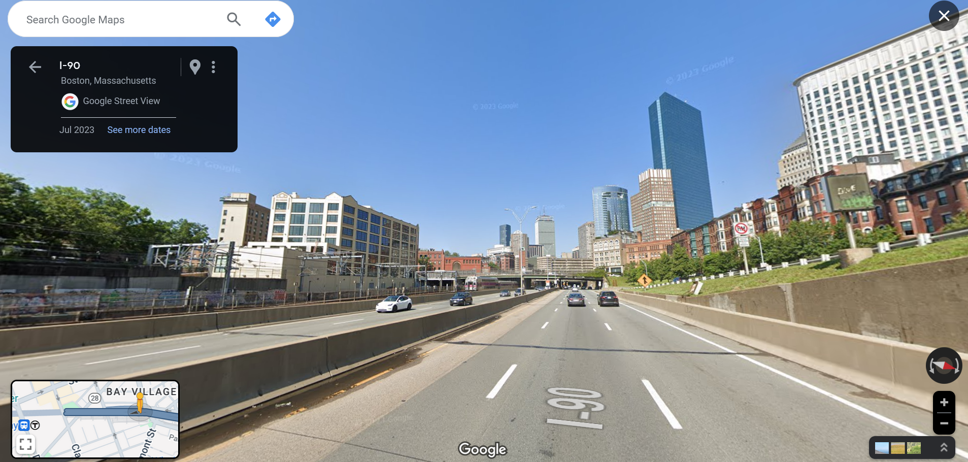
This is it!! Down to the lamppost, this is the place. To take this photo, the person must have been on the bridge behind us. So, the street name is Arlington Street and it’s in Boston!
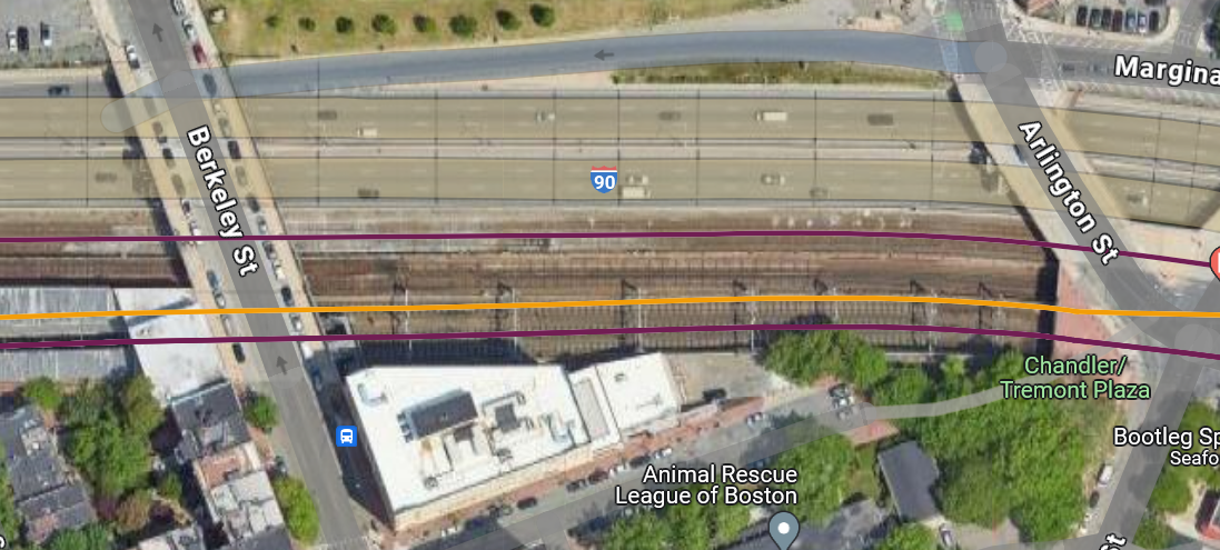
The flag for Night is uiuctf{Arlington Street, Boston}
Challenge 2: Chunky Boi
Description
Information gained from prompt
- chal.jpg
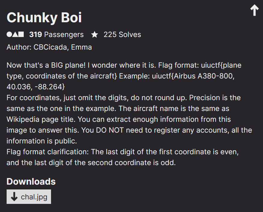
chal.jpg
Information Gathering Stage
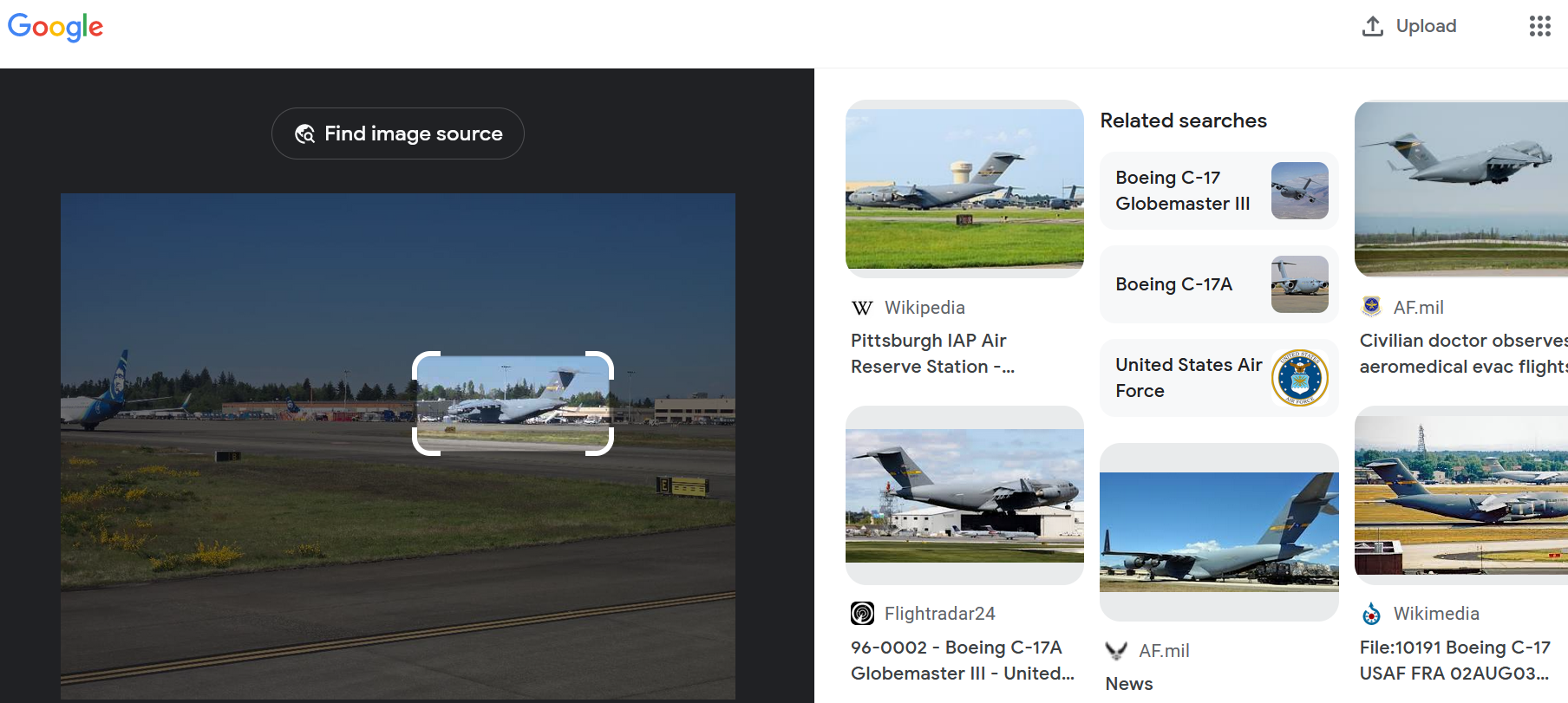
We need the plane and the coordinates. Google Lens gives us that it is the Boeing C-17 Globemaster III right off the bat, so off to a good start.
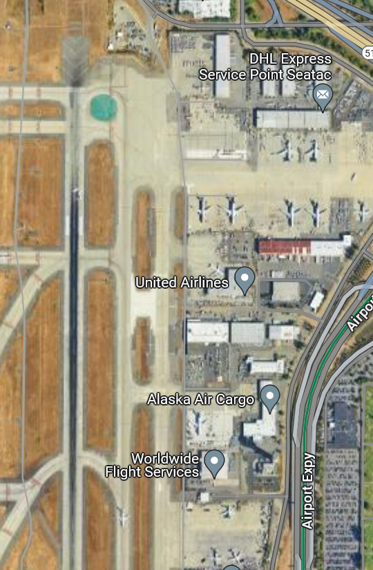
Next we need to know where it is, and it looks like an airport since we have three planes visible and some sort of runway and a part of the terminal. Two of the planes belong to Alaska Airlines, so maybe we need to find a main hub. According to Wikipedia, Alaska Airlines is headquartered near Seattle-Tacoma International Airport.
Now we have the plane and the airport, but how do we figure out the exact coordinates? We need a map.
We find the following airport diagram below on the Aircraft Owners and Pilots Association website.
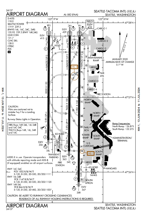
The big plane that we are looking for is not for commercial travel, so it would probably not be near the terminal, so according to the map, we need to be looking in the Northeast area of the map.
Thinking Stage
Here is how the Northeast area of this diagram looks on the satellite map:
We see that planes are in the open only near the very North edge, so we zoom in. We also take note of runway signs for E and B as well as the sign for directions to runways D and C.
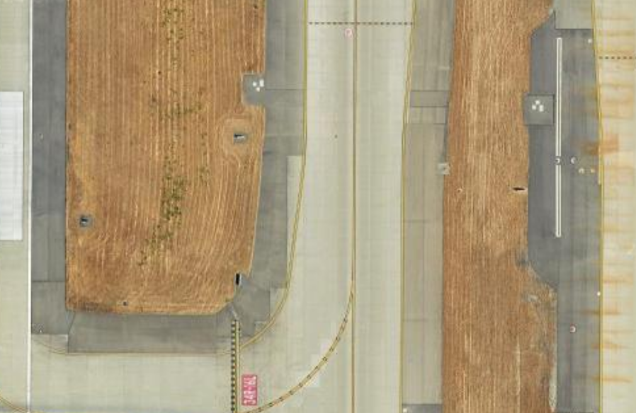
We notice that these lines must be those signs. So, we try to orient ourselves to better understand where the plane is using that information.
The Solve
After doing that, it was easy to tell that the huge plane would be in the really big parking space.
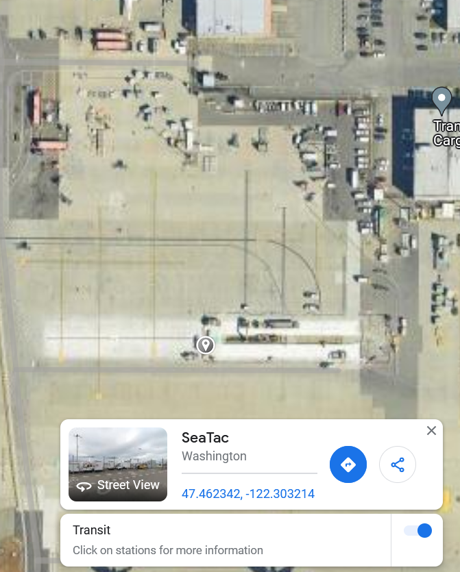
Clicking on that area gives us the coordinates 47.462, -122.303 (as requested in the prompt to round to just omit the digits and not round) for the flag. That gives us the last piece and we have completed this challenge!
The flag for Chunky Boi is uiuctf{Boeing C-17 Globemaster III, 47.462, -122.303}
Challenge 3: New Dallas
Disclaimer: We did not solve New Dallas during the competition timeframe
Description
Information gained from prompt
- wide road…?
- chal.jpg
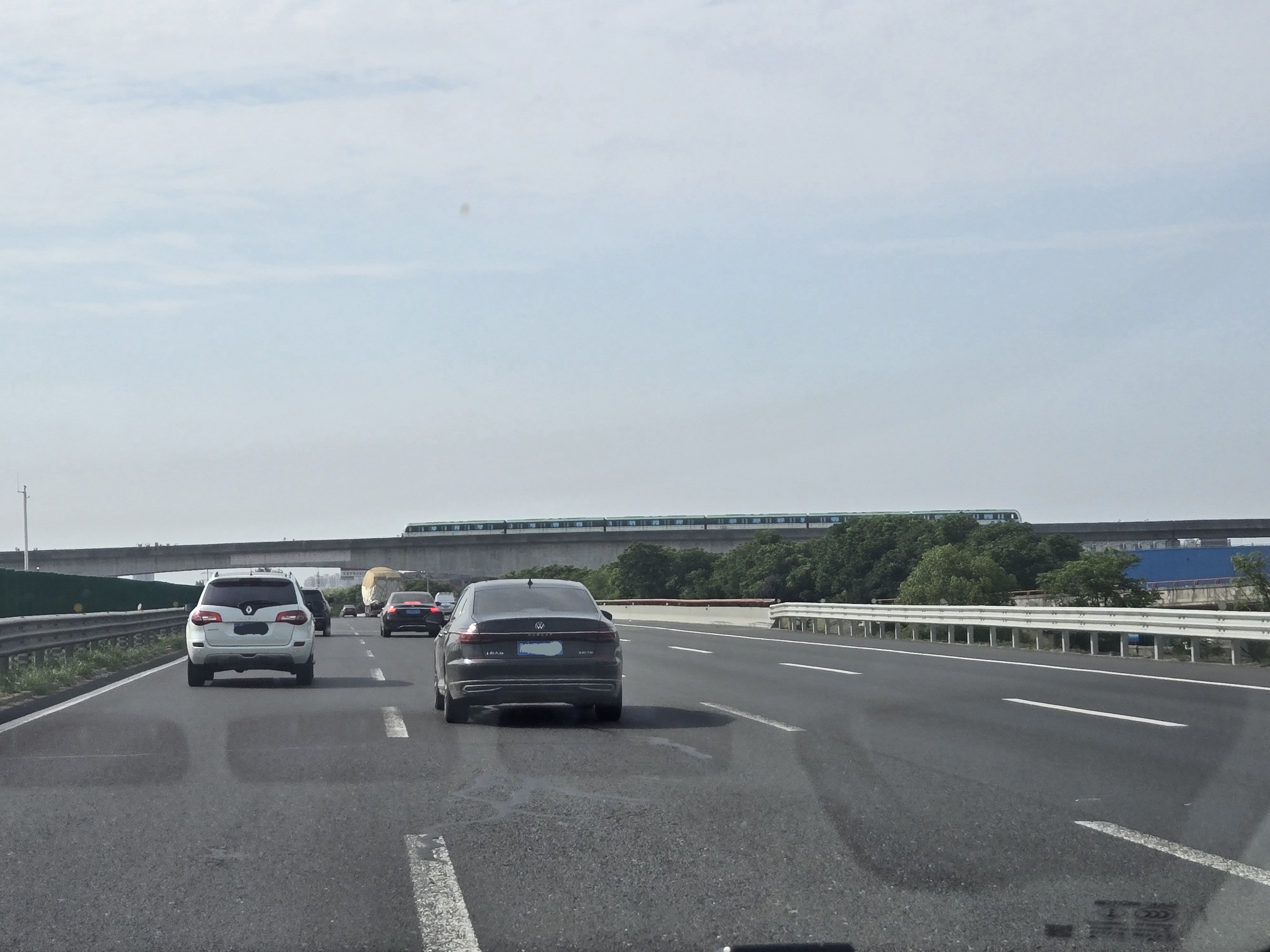
chal.jpg image
Information Gathering Stage
In our image we have cars, a road, and a metro line or train of some sort. The license plates are blue and after looking online, we can see that the main place with plates like these are China. In addition, to back up that claim, we noticed some Chinese characters on one of the cars.
Then for the info about the metro. Things of note are:
- sort of greenish/teal
- currently above ground
- is on a bridge
- near a big road
Thinking Stage
Since there is no more information we can gather from the image, we go to our friend Google and look for metro lines in China, maybe there’s not many green ones? You’d be wrong. Since we really have no idea where in China it could be, we still have a huge search radius and it looks like there are hundreds of possible metro lines. We have several Wikipedia pages open that have so many metro lines, we don’t know where to start.
We try to go through them one at a time, but keep getting distracted. What we should have done was the following.
- go to china metro list
- find a list by area
- go down one by one and see if there are any matches
The Solve
We did not end up solving this challenge during the competition time frame, however during the closing ceremony, it was revealed how to come to the solution.
Essentially, we just should have been doing what we were but more organized. We were checking all the different lines not in any order or writing them down because the challenge seemed to overwhelming.
If we had done the steps we wrote out, we would have found that the image corresponds to the Wuxi Metro Line 2.
After that, we need to go along the map and try to find a wide road along the path. This metro line is very long, but there are not many places where it intersects with a large road. We would have found this intersection on Maps.
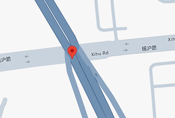
However, it seems that even teams that go to this stage were having confusion. This is because if you turn on satellite maps, what Google Maps is actually showing here is their overlay, and the map of the Earth does not match up to it!
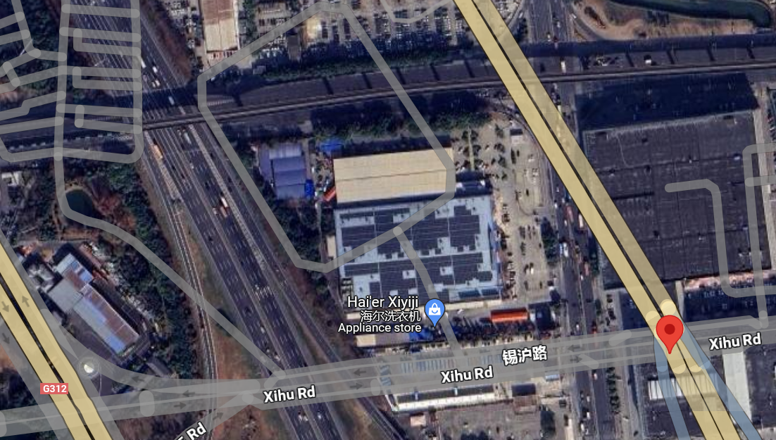
This was also likely a tangential source of our confusion.
The flag for New Dallas is uiuctf{31.579, 120.388}
Written and formatted by @goldenscience